
Services
- Boundary Surveys
- Topographic Survey
- ALTA/NSPS Survey or Extended Title Insurance Coverage Survey
- Elevation or Floodplain Survey
- Site Survey
- Lot Split Survey
- Construction Survey
- Improvement Location Report
- As-Built Survey
- Subdivision Survey
- Additional Services
Boundary Surveys
A boundary survey establishes the true property corners and property lines of a parcel of land. Boundary surveys are typically performed to obtain building permits, to resolve property disputes, and for erecting fences. Easement lines may also be located, if requested, with this type of survey.
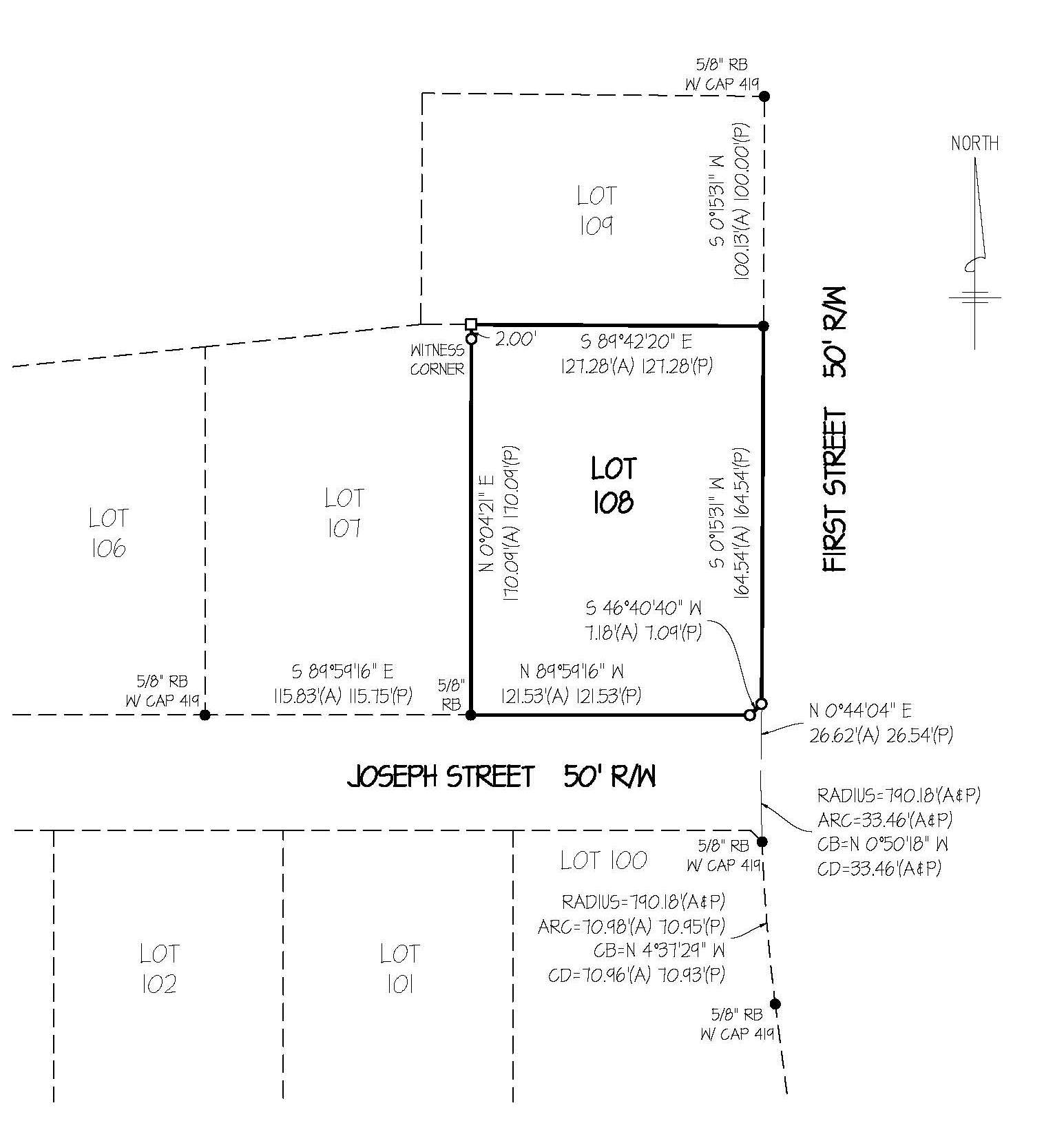
Topographic Surveys
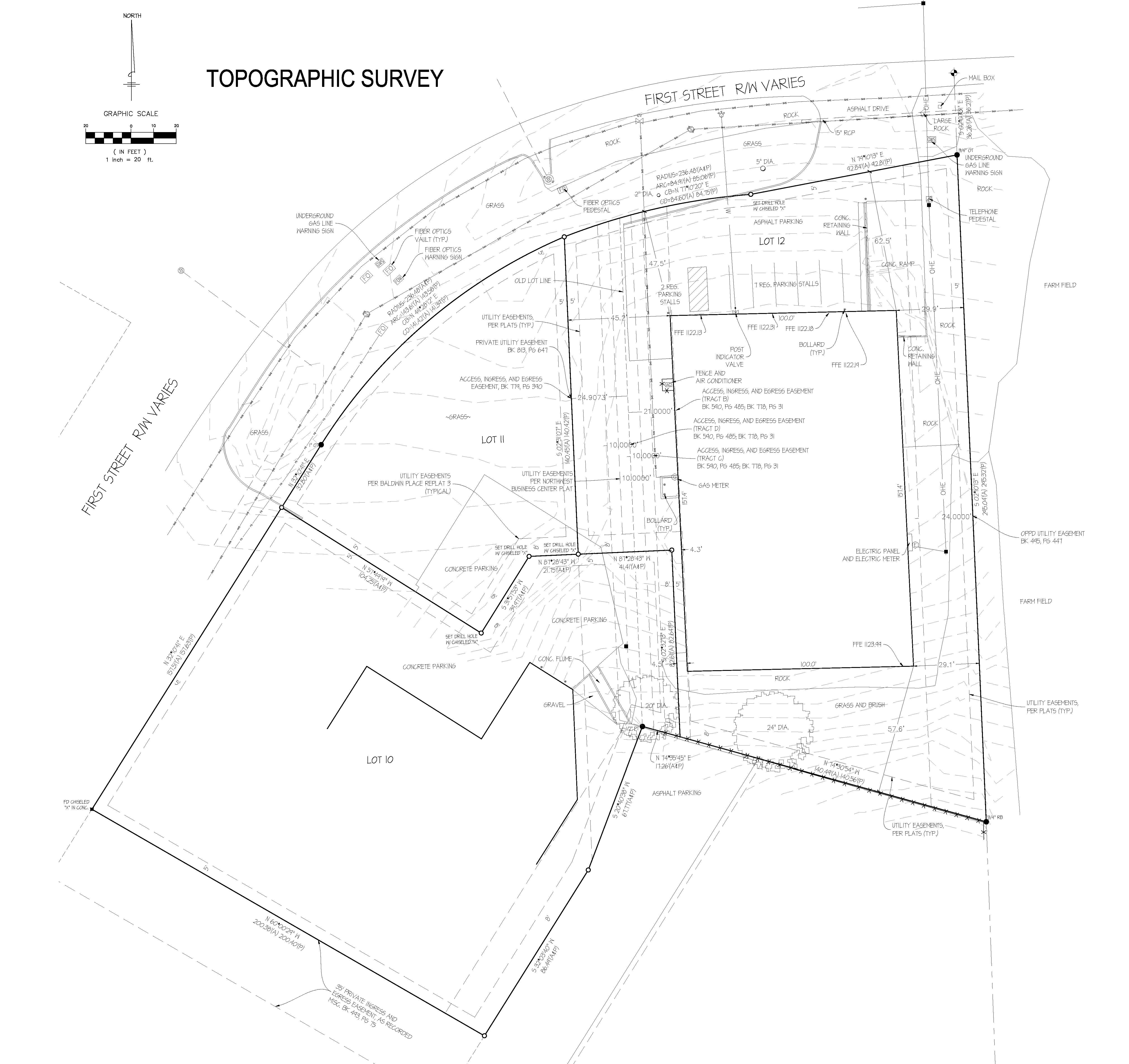
A Land Survey locating natural and man made features such as buildings, improvements, fences, elevations, land contours, trees, streams, etc. This type of survey may be required by a government agency, or may be used by Engineers and/or Architects for the design of improvements or developments on a site.
ALTA/NSPS Survey or Extended Title Insurance Coverage Survey
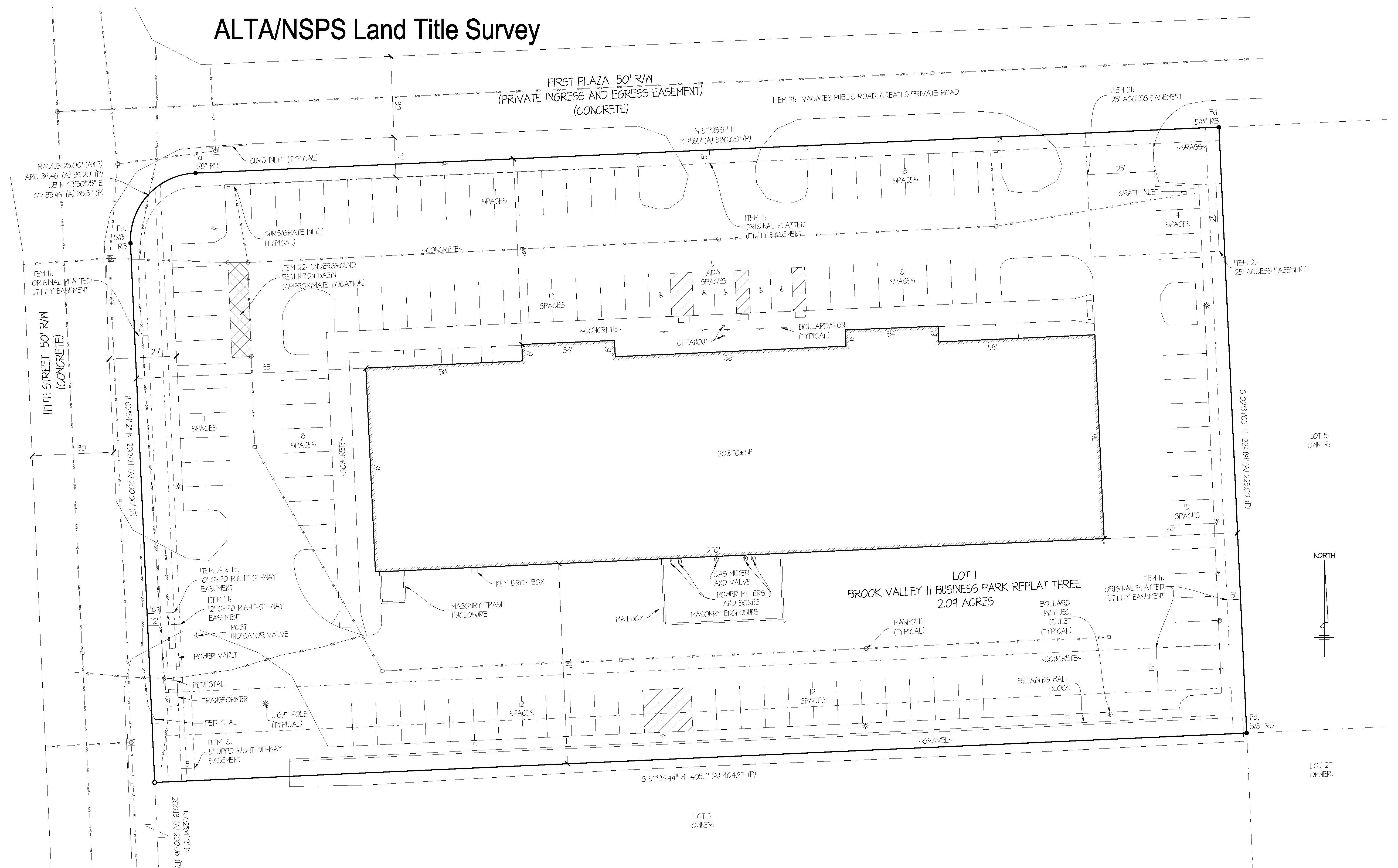
A survey made for the purpose of supplying a title company and lender with survey and location data necessary for the issuing of title and/or mortgage insurance. A detailed map is required to be done to “ALTA” specifications. The acronym "ALTA" stands for American Land Title Association. Specifications of this type of Survey include (but are not limited to) determining property lines, location of improvements, identifying all easements, utilities and other conditions affecting the property. ALTA surveys are very comprehensive surveys and typically cost thousands of dollars and take weeks to complete. Any ALTA Land Survey must meet the "Minimum Standard Detail Requirements for ALTA/NSPS Land Title Surveys" as adopted by the American Land Title Association and the National Society of Professional Surveyors. The Alta Survey is most often performed on commercial properties.
Elevation or Floodplain Survey
Elevation surveys determine the elevation of various sections of a building or land. Typically these are used to aid in building plans and to determine if a property is in a flood zone.
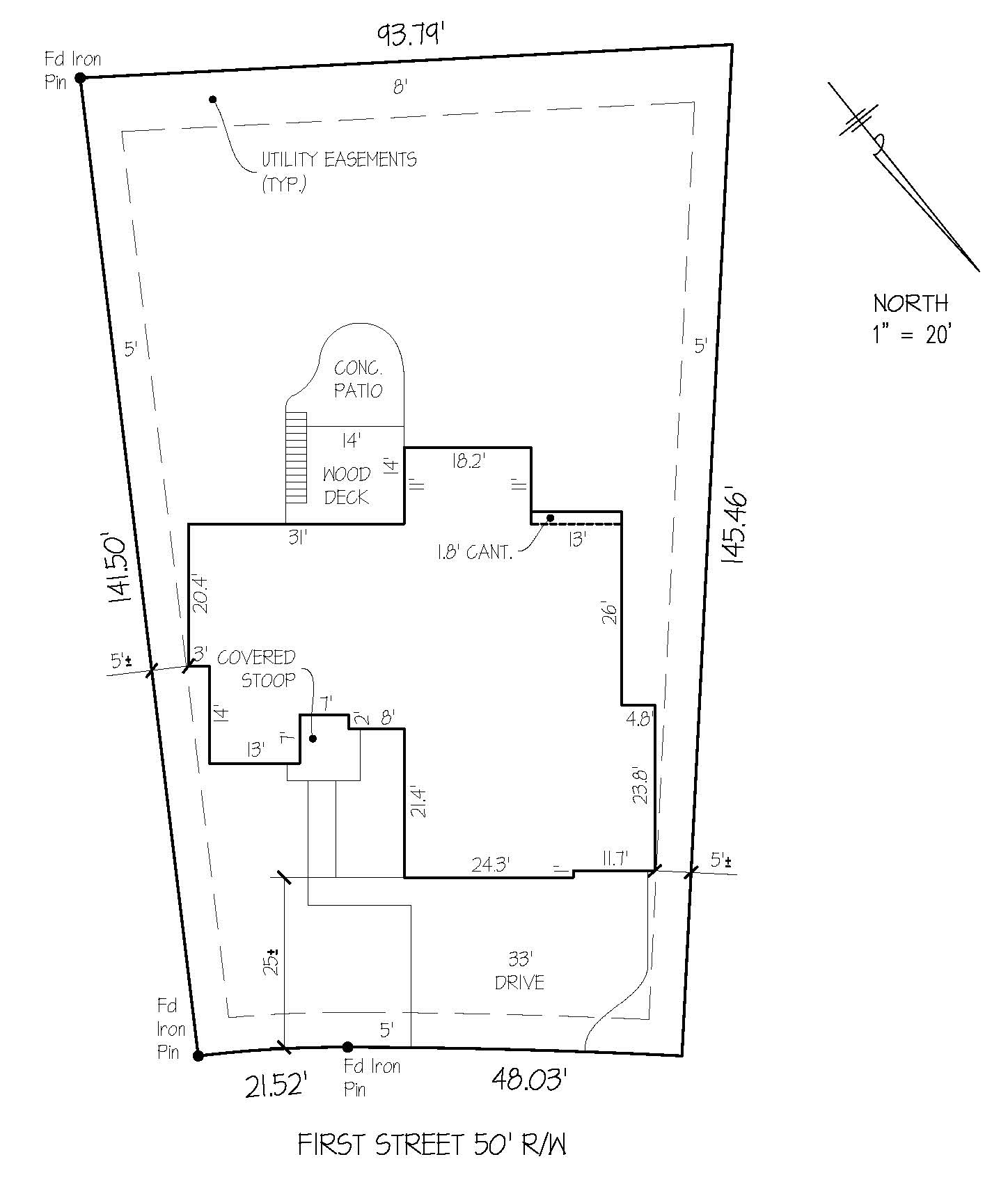
Site Survey
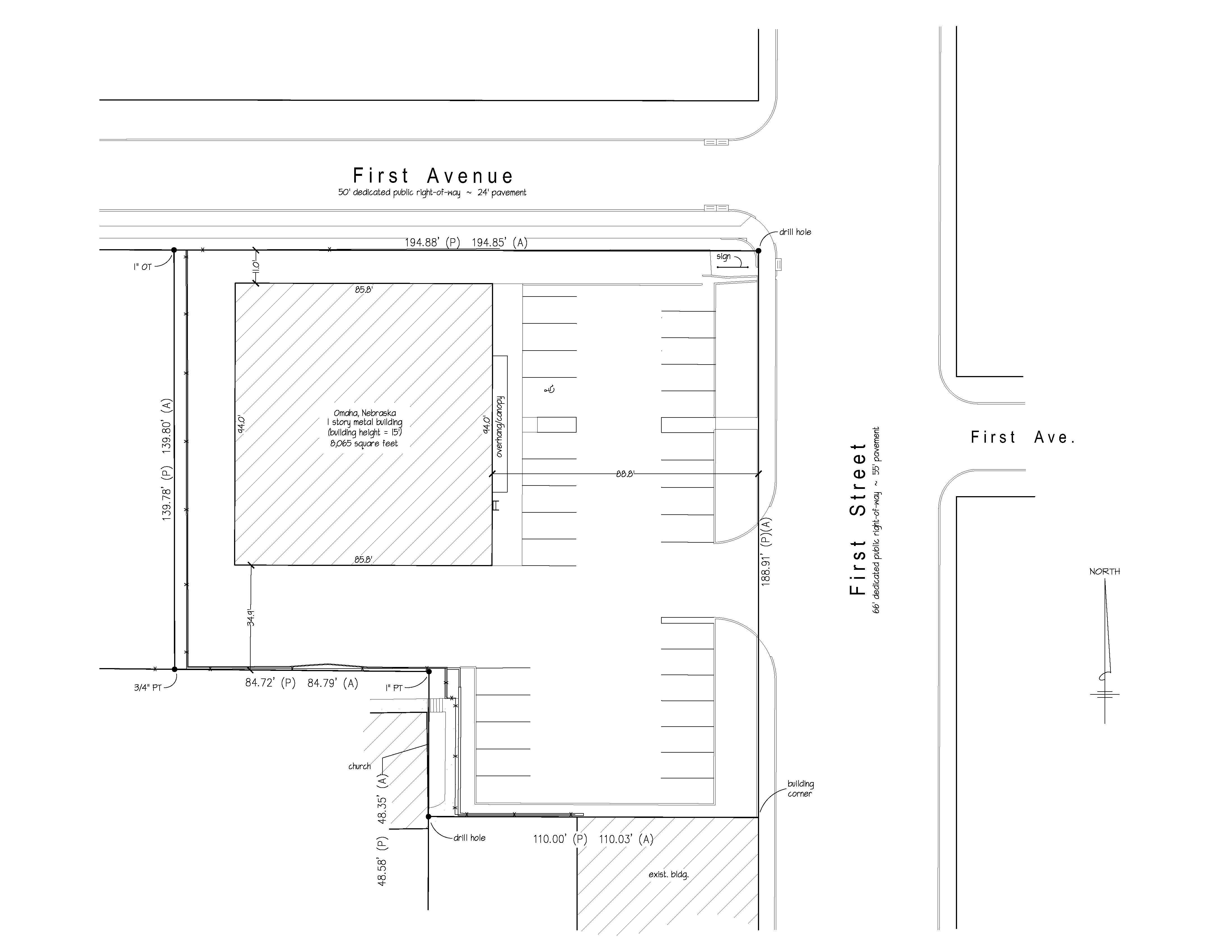
Also known as Site Plan or Plot Plan Survey, a combination of boundary and topographic surveys for preparation of a site plan to be used for designing improvements or developments, and obtaining government building permits.
Lot Split Survey

Are needed when you may need to divide an existing parcel of land into two or more parcels. All surveys for lot splits include a plat of the new parcels and the required legal description to record the split. It is important to note the size of the original parcel as well as the size of the proposed new parcel(s) in the comments section of the request form in order to receive accurate quotes.
Construction Survey
Survey measurements made prior to or while construction is in progress to control elevation, horizontal position, dimensions, and configuration, i.e. stakeout of line and grade for buildings, fences, roads, etc.
Improvement Location Report
Also known as Mortgage Location Survey and is not necessarily a Land Survey. These surveys are typically used by title companies and mortgage lenders to obtain proof that the major improvements on the property are free of encroachments onto neighboring properties or into recorded easements. Mortgage surveys do not establish property corners or property lines and may not be used for building purposes which may include fences and building improvements. Look for the “Certification” of the Land Surveyor, which usually includes the signature with the Land Surveyor’s license number, and State of Practice.
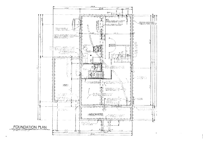
As-Built Survey
A survey performed to obtain horizontal and or vertical dimensional data so that a constructed facility may be delineated, i.e. foundation survey, or as-built of improvements. Specifically, an As-Built Survey is a survey to physically locate structures and improvements on a parcel of land. This does not always include boundary monumentation or utility location.
Subdivision Survey
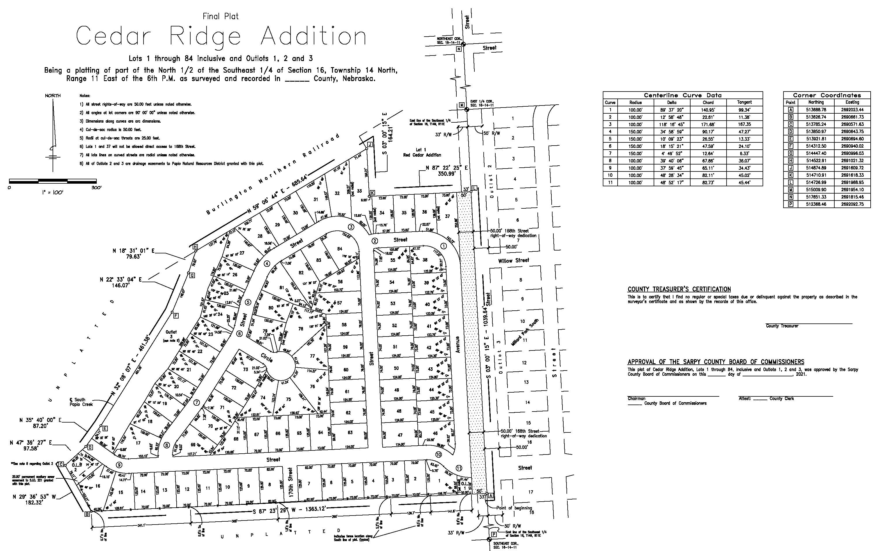
Also known as a “Subdivision Plat”, it is the subdivision of a tract of land into smaller parcels, showing monumentation and mathematical survey data on a map, conforming to local Government (usually County) ordinances.